
Free
Run Strata on your own data — no account required.
- Serve + Ask, single machine
- ArcGIS REST FeatureServer + Vector Tiles
- Capped layers & users
- Community support
One platform, two capabilities. Serve publishes your data as ArcGIS-compatible FeatureServer + Vector Tile services. Ask lets anyone explore it in plain, natural language — with a fully on-prem, local-LLM option. A single, dependency-free binary you install in minutes.
 ▶ See it serving
A GitHub pull or a double-click — no Portal, no web adaptor, no data store to stand up, no planning cycle. Run it on your laptop, then replicate behind a load balancer for high availability.
Dependency-free. No database to run — DuckDB is embedded.
Your servers, your cloud, or a laptop. Your data never has to leave.
Lightweight enough to replicate behind a load balancer for an HA pair.
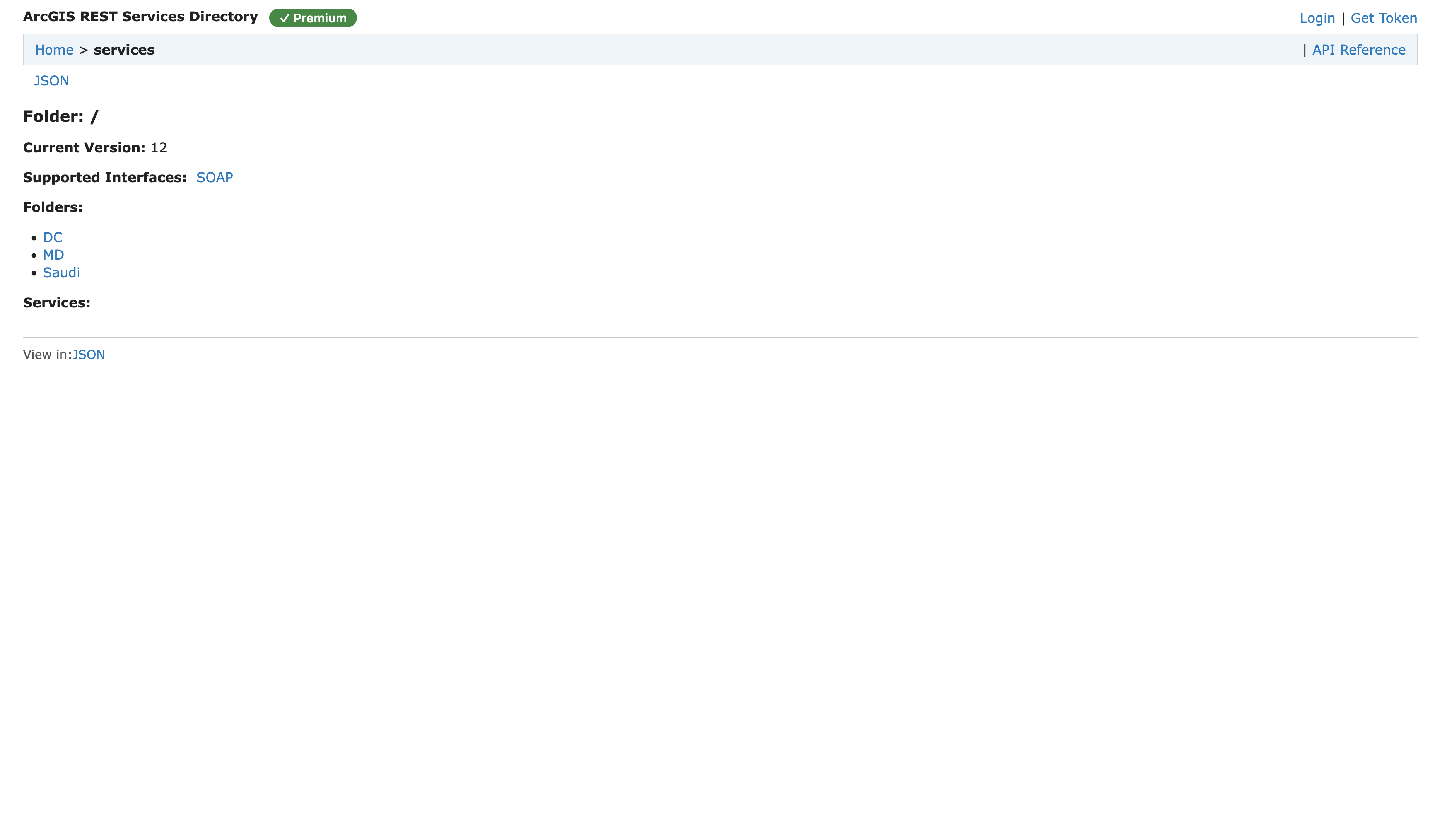
Upload a GeoJSON, Shapefile or CSV into the Strata Data Store and it's instantly an ArcGIS-compatible FeatureServer + Vector Tile service. Browse it like an ArcGIS services directory; ArcGIS Pro, the Maps SDK, QGIS and MapLibre connect unchanged.
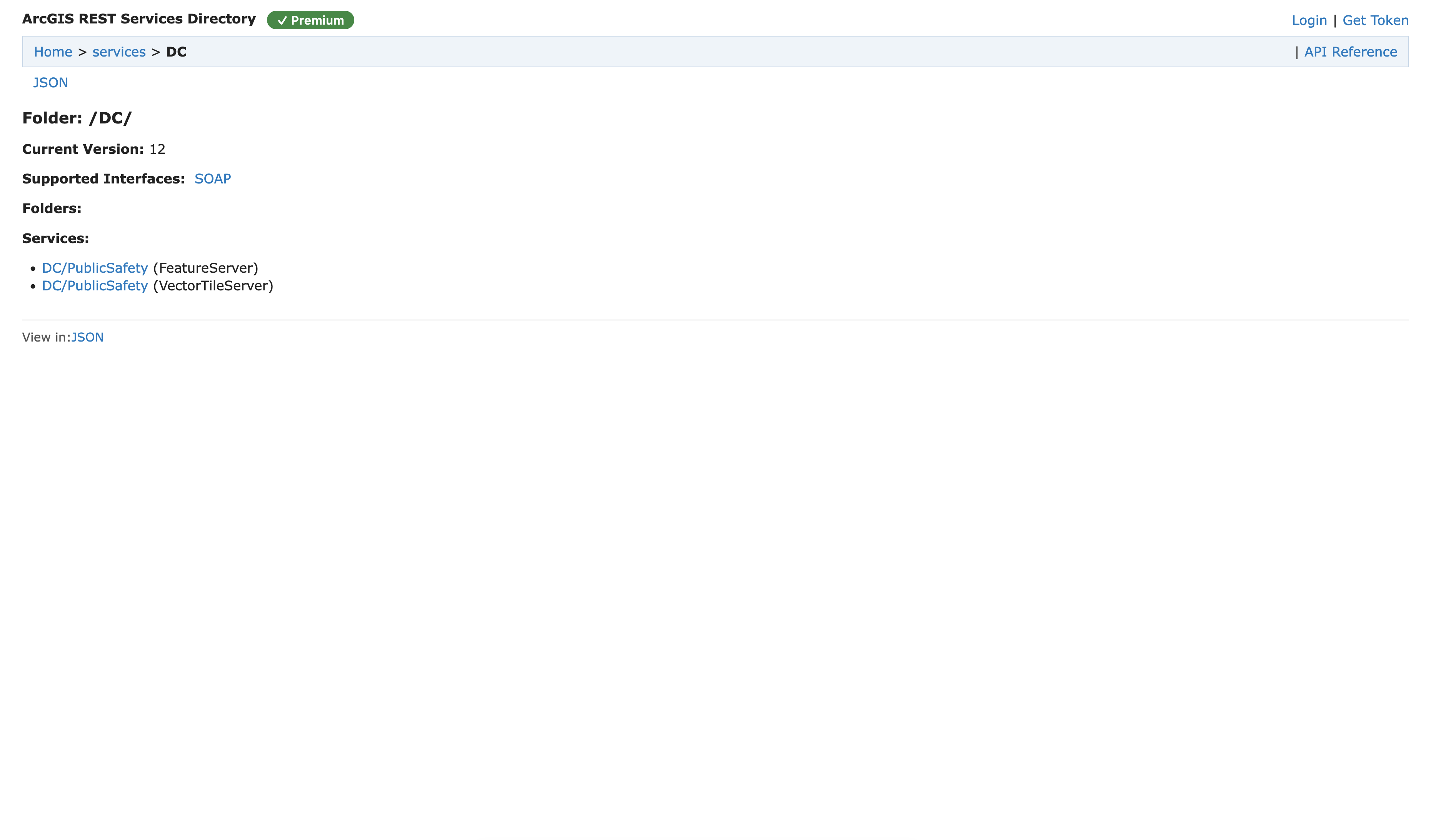
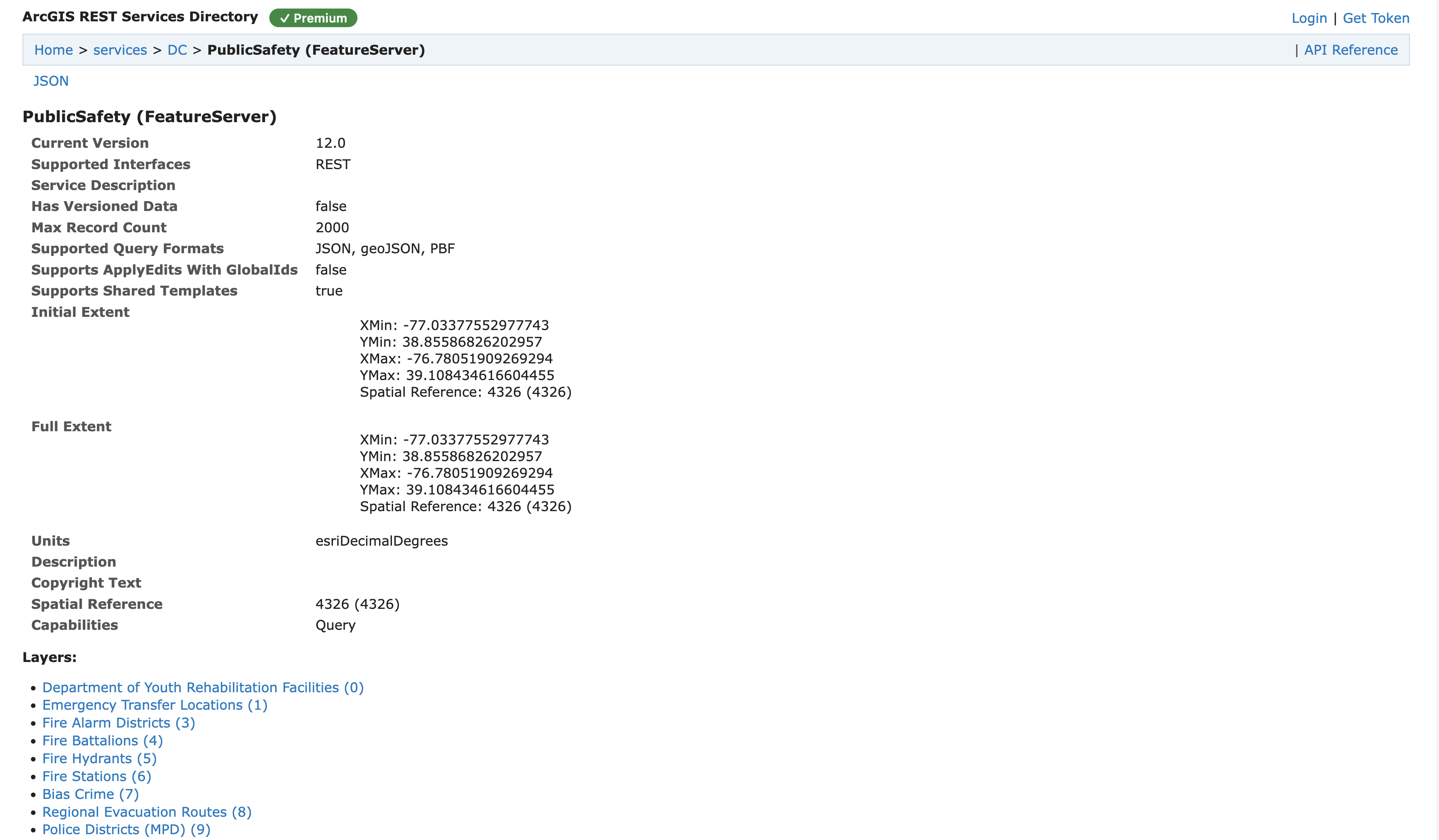
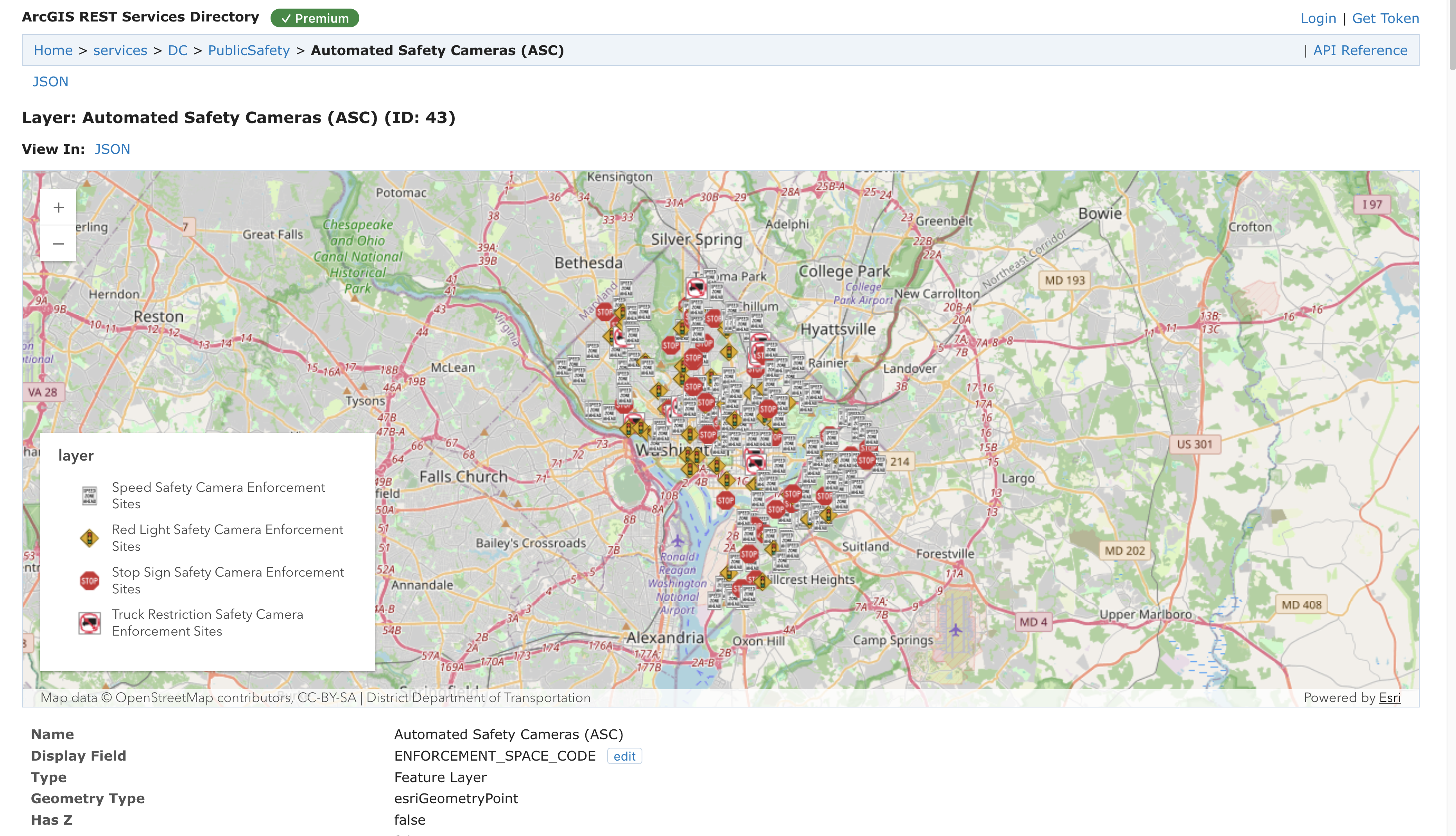
Fully compatible with your ArcGIS Pro
FeatureServer + VectorTileServer endpoints, query, statistics, top-features, bins, generateRenderer, related records.
Serve GeoParquet from local or cloud (S3) storage directly via DuckDB — no import step, no database to run.
Discoverable from Pro's “Add Server”, with the catalog handshake and folder-scoped services.
Generate MapLibre / Mapbox GL style JSON for your vector tiles — drop it straight into a web map.
Ask turns plain-language questions into live maps, tables and charts over your data. A conversational assistant for everyone, a deterministic no-hallucination command mode for professionals, and a fully on-premises, local-LLM option so your data never leaves the building.
Which wards in DC have the most schools?
Top 3 wards by number of schools:
Query ran on your Schools layer — 251 features.
Buffer the hospitals by 2 km and color them by capacity
Done — 9 buffers added to the map, styled with 5 class breaks by capacity.
A scripted preview — the real product runs live on your ArcGIS services.
Ask questions and give instructions in plain language; replies always match your language — Arabic included.
Composer commands run with no model in the loop — predictable, no-hallucination operations for pros.
An orchestrator plans and delegates to specialists for query, analytics, geoprocessing, styling and charts.
Class-breaks, unique-value, heatmaps, clustering, labels and popups — generated from a description.
Run fully on-premises with a local model (Ollama), or use a cloud model — your choice per deployment.
A built-in MCP server lets external AI assistants (e.g. Claude Desktop) drive the live map.
Serve is read-only today. Naming what Strata doesn't do is what makes where it wins believable to an Esri-savvy buyer.
Editing via REST (applyEdits) is planned for a later release, scoped to non-authoritative data collection — authoritative, versioned editing stays Esri's job.
Strata is an independent, interoperable product. “Compatible with ArcGIS®” describes interoperability only.
Ask (AI) is included at every tier. Try it online, run Free on a single machine, or license Enterprise with uncapped users — self-hosted or hosted by us.
Run Strata on your own data — no account required.
Everything in Free, plus uncapped scale and support — on your servers or ours.
Supabase / Directus, but for GIS data. A headless spatial backend — data serving + AI, then user management and per-layer permissions on the roadmap — that gives your app teams just the right backend, then gets out of the way.
Everything you can try right now — the ArcGIS-compatible serving engine and the AI assistant — is shipping and free to run. The full framework vision goes one step further.
FeatureServer + Vector Tile services over the ArcGIS REST protocol.
Natural-language querying, analytics and styling, with a local-LLM option.
Build on Strata: open solution repos, technical docs, and the ArcGIS REST surface. Serve GeoParquet from local or S3 via DuckDB — FeatureServer + VectorTileServer, no import step. DIY free, or get it delivered.
Every solution starts from an open template you can build yourself for free — or have us deliver and support the finished result.
A live common operating picture for public safety — incidents, assets and hazards on one map. DIY free, or get it delivered.
See on GitHub →Site selection, catchments and collateral risk in flood zones — on-prem, behind your perimeter. DIY free, or get it delivered.
See on GitHub →An ArcGIS Hub–style open-data portal, catalog and public map site you host yourself. DIY free, or get it delivered.
See on GitHub →Honest, concrete answers — framed for coexistence with your existing Esri stack.
Yes. Strata serves your data over the ArcGIS REST protocol (FeatureServer + VectorTileServer) and starts free. It's built to coexist — keep your Esri licenses and run Strata for the web-facing tier.
Point Strata at a GeoParquet file on local disk or S3 and it's instantly an ArcGIS-compatible FeatureServer — DuckDB reads the Parquet directly, with no import step and no separate database to run. Clients like ArcGIS Pro, the Maps SDK, QGIS and MapLibre connect unchanged.
Yes — Strata's Ask runs fully on-premises with a local model (e.g. Ollama), so your data never leaves the building. You can also use a cloud model per deployment; it's your choice. There's also a deterministic, no-hallucination command mode for professionals.
Yes. Strata publishes GeoParquet as ArcGIS-compatible FeatureServer + Vector Tile services and can emit MapLibre / Mapbox GL style JSON — so your Parquet becomes live web layers you can drop straight into a web map.
Yes. Strata is discoverable from ArcGIS Pro's “Add Server” and speaks the ArcGIS REST protocol, so Pro, the ArcGIS Maps SDK for JavaScript, QGIS and MapLibre all connect unchanged — no migration and no client changes required.
Yes. Ask supports a fully local LLM (e.g. Ollama) so no data or prompt ever leaves your network. Cloud models are optional and chosen per deployment.
Try Strata online for free, or install the Free tier on your own server. Enterprise gives unlimited layers, uncapped users and up to two machines, and Hosted is Enterprise run by us. Ask (AI) is included at every tier. Solutions are priced per outcome — start free with the open template or contact us for a quote.
Serve is read-only today. Editing via REST (applyEdits) is planned for a later release, scoped to non-authoritative data collection — authoritative, versioned editing stays Esri's job. Naming the boundary honestly is part of how Strata coexists with your Esri investment.
Machine-readable for AI assistants: read the llms.txt at /llms.txt.